Hiking the Grinnell Glacier Trail in Glacier National Park


Hike at a Glance
Distance: 11.3 miles, 1600 ft gain
Duration: 5-7 hours
Type: Out and back
Trip Date: Aug 23, 2019
My Rating
Overall : 🌲🌲🌲🌲🌲
Scenery: 🌲🌲🌲🌲🌲
Difficulty: 🌲🌲🌲
Busyness: 🌲🌲🌲🌲🌲
The Grinnell Glacier trail has glacial lakes, wildflower meadows, and unobscured cliffside views that culminate in an up-close look at Grinnell Glacier and Upper Grinnell Lake. This trail is family-friendly with its mellow grade and option to shorten the distance with a shuttle boat ride. Despite the crowds, I think it is a must-hike and a quintessential introduction to Glacier National Park scenery.

Elevation profile for the Grinnell Glacier Trail (view in AllTrails)
Hike Overview
The Grinnell Glacier trailhead (Google Maps) is located in the aptly named Many Glacier area of Glacier National Park. This area is also home to the park’s favorite lake hikes including the trails to Cracker Lake, Iceberg Lake, Ptarmigan Lake, and Bullhead Lake. The Grinnell Glacier trail is level for the first 2 miles until the southern end of Lake Josephine. There is a boat shuttle across Swiftcurrent Lake and Lake Josephine run by the Glacier Park Boat Company that you can take each way to reduce the round trip hike by 4 miles.

In the backdrop of Lake Josephine is Angel Wing, the mountain that you’ll have changing views of throughout the hike
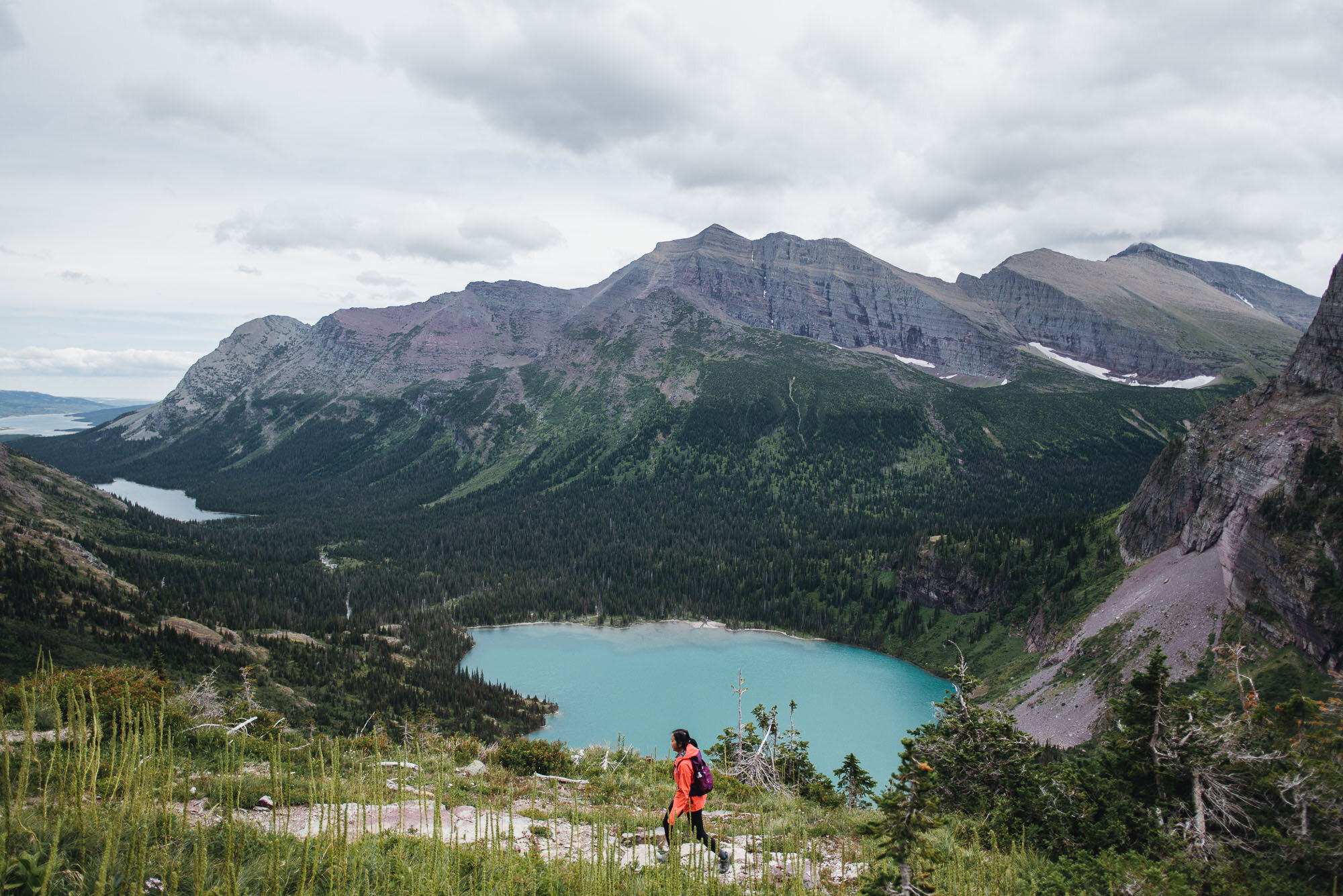
We chose to hike the 2 miles since it’s a nice flat walk. The trail met the shore of Swiftcurrent Lake briefly and then arrived at Lake Josephine after a mile. Then it followed the shore of Lake Josephine for another mile. Once past Lake Josephine, the trail started climbing the southern flank of Mt. Grinnell and stayed up high which gave us stunning views of Grinnell Lake. The water’s vivid emerald color is characteristic of glacial lakes because of glacial erosion that grinds the rocks into a super fine “rock flour” that stays suspended in water.
The last part of the hike was a few switchbacks to reach the top of the shelf where the glacial basin sits. This was the steepest part of the hike, which meant frequent breaks where we got to take in the amazing view of all three lakes in the valley behind us. Once we reached the top, the trail split off into many use trails leading to Upper Grinnell Lake and its surrounding glacial basin. The sky became overcast as we arrived at the glacier basin and it turned cold quickly, as if to match the barren, icy landscape in front of us.
It was hard to imagine, but Grinnell Glacier used to fill the whole area we were standing in. Global warming and the receding glacier left behind a body of milky blue water dotted by floating icebergs. Salamander Glacier was perched on a ledge halfway up the Garden Wall, the name of the ridge that is part of the Continental Divide. If you look closely enough, you might spy tiny hikers standing on top at the Grinnell Glacier Overlook (a detour off a different trail, the Highline Trail).
We took a picnic break by the lake and explored the basin area before taking the same trail back to the trailhead.