Brother's Point (Rubha nam Brathairean)
Brother's Point is an oddly-shaped headland that is a short 10-minute drive north from Old Man of Storr. This place was amazing and truly a hidden treasure (hopefully still hidden due to all the bloggers posting about it now!). It looks a little like Neist Point at first glance, but the similarities end there. Neist Point is more of a vista point while Brother's Point is a journey as well as a destination. The walk to Brother's Point traverses grassy bogland and a pebble beach, accompanied by views of the rugged coastline the entire way. It is quintessential Scottish highlands and not to be missed!
How to get there
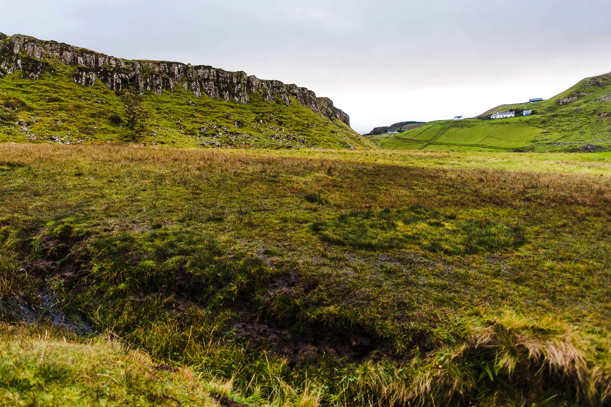
Brother's Point was hard for us to find. In fact, the first time we were there, we didn't do our research and couldn't find it. We went back a second time, which is why the weather in the photos might look different. I've pinned the parking location for Brother's Point on the right. There's a small sign for Brother's Point at the parking lot so you'll know if you've found it. Once you've parked, walk towards Skye Pie Cafe and take the short gravel road across from it. Walk past the small house (see the first photo below). We had to move a sketchy, falling-apart metal fence to cross the path at one point. You'll find a sign labelled Rubha nam Brathairean pointing to a trail heading downhill on your right. Keep reading below to see photos of the entire trail!
Tips for visiting
Allow 2-3 hours for this relatively flat, but very scenic hike. If you have waterproof hiking shoes/boots, they will definitely come in handy. Otherwise, be mentally prepared for soaked socks and shoes. The trail sort of disappears once you reach the beach, so you have to find your own way across the marshy areas. If it has rained recently or if there are high winds, this hike may be dangerous or quite unpleasant.


Below is one of the few signs letting you know you're at the right place. After this sign, there are no more signs.


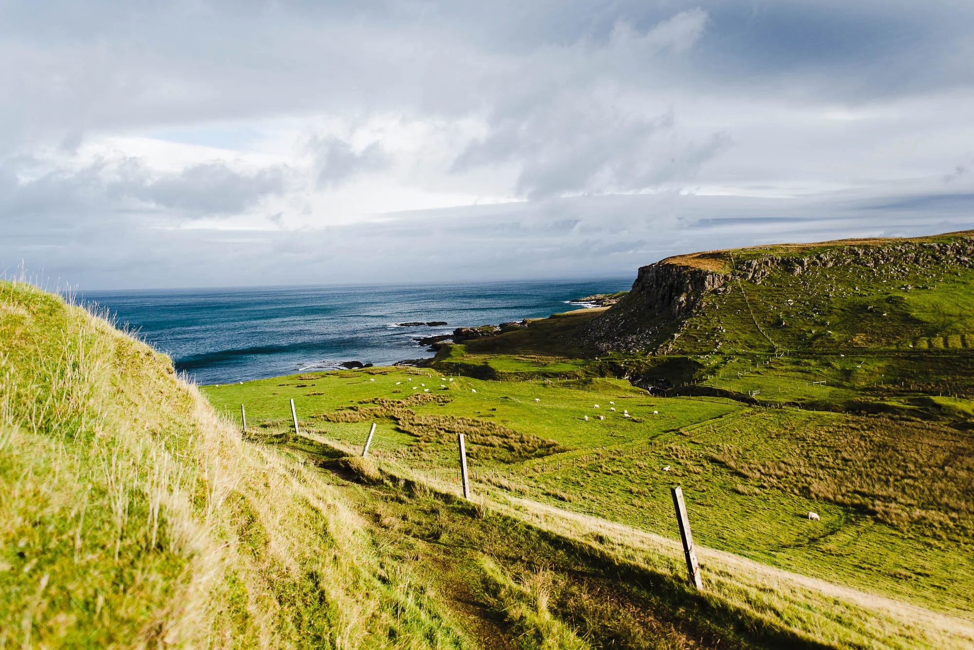
Once you reach the bottom of the trail, walk all the way down to the pebble beach. It'll reduce the amount of bog-hopping you'll do, but you'll also have to be careful around the slippery, seaweed-covered rocks on the beach. The first time we got here, we had absolutely no idea where the trail continued to, because the trail actually disappears here. We backtracked a little bit and then climbed up a maybe 70-degree grassy slope until we were literally on top of the headland in the foreground...yup no Brother's Point there. If you look above the sheep in the photo, the tiny sunlit mound next to the headland is Brother's Point.


Keep walking in the direction of Brother's Point. You'll gradually start climbing upwards from the beach along the cliffs. Eventually you'll be able to reach the flat top of Brother's Point. It looks impossibly steep, but there's actually a trail that goes up it.


Finally, you'll reach a wide flat area with a breathtaking view: Brother's Point. I highly recommend walking along the grass ridge and climbing up to the plateau for a view of the massive headlands behind you. The trail up is narrow and steep but not dangerous.


If you get lucky, you'll catch a group of sheep grazing here. I snapped many photos of their butts as they ran away from me...


Because this spot is still relatively undiscovered, we did not see any other people on this trail besides one group that we passed by on our way back. Having this landscape to ourselves made it feel even more remote and grand. Just make sure to come prepared because there will be no one to ask for directions if you get lost like we did the first time. Have fun hiking and let's try to keep this place on the down low ;)